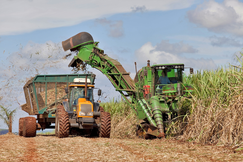
Harvesting is a critical step in the productivity of sugarcane farming. Precise drone surveys can help to automatically design optimal lines for mechanized operations. Gamaya has tested the accuracy of RTK/PPK drone surveys to deliver the required results, whilst minimising the time spent on the field.
What is an RTK/PPK drone?
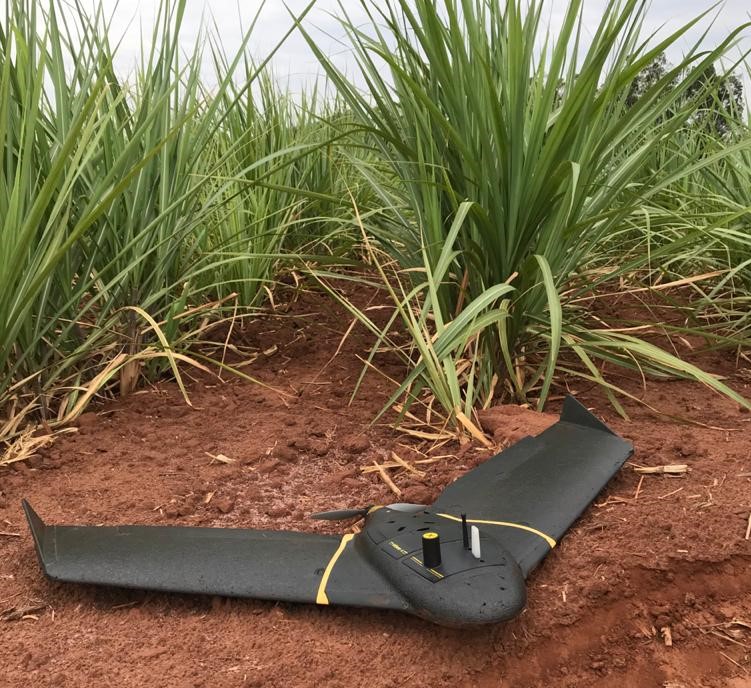
Drones have been gaining traction for on-demand insights collection, for a more efficient and sustainable agriculture. The increasingly affordable RTK/PPK drones now add an additional value with their high-level of accuracy.
An RTK drone (Real Time Kinematic) is equipped with a GNSS RTK receiver that gathers data from satellites and a ground base station to accurately record image location in real time during the flight. These calculations correct the camera positions both horizontally and vertically by up to 2-3 cm in accuracy.
A PPK drone (Post Processed Kinematic) has a GNSS PPK receiver onboard that collects data from satellites and logs it for retrieval after the flight. The computation referring to the ground reference is performed only after landing, with a dedicated software.
RTK/PPK drones could remove the need for Ground Control Points (GCPs), assuming the connectivity remains constant throughout the survey.
The importance of accuracy for sugarcane harvest lines
In sugarcane crop production, the trampling of sugarcane stalks is one of the most significant factors leading to a reduction in productivity.
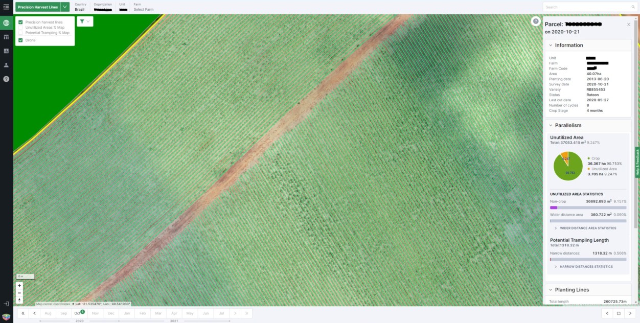
Gamaya CaneFit offers a solution to automatically extract precision harvest lines from an orthomosaic. These can later be imported into GPS-equipped machines which can perform accurate harvests on autopilot.
When performing a drone survey, traditional methods use Ground Control Points (GCPs) to ensure survey-grade accuracy. Today’s RTK/PPK drones are an alternative reducing the amount of time spent surveying the field.
We have investigated the accuracy performance of different RTK/PPK drones on the same field, generating an orthomosaic, as well as having well-distributed checkpoints on ground in order to control the absolute accuracy of the results.
This comparative study between RTK/PPK drones will help Gamaya advise its users to get the best possible quality in the detection of the sugarcane harvest lines for further use in machinery equipped with an autopilot.
Comparative analysis
We have collaborated with several sugarcane growers in Brazil and visited their farms. We took the following criteria into consideration when choosing the test parcel:
- Area between 50 to 100ha
- 30 to 60 day cane, for visits in the next 60 days
- Ribeirão Preto region
- Easy access
- Far from urban areas and airports, to avoid reception issues and flight authorization limitations
- Authorization from the owner to make several visits, flights, and GPS measurements

The tested drones solutions for the images collection were the following:
The flights were performed to ensure a GSD (Ground Sampling Distance) of 4cm.
In all cases, the same mosaic generation methodology was used, i.e:
- Upload the geotagged images via the Gamaya Uploader
- Orthomosaic generation using Pix4Dengine for the images processing
- Results were available on the Gamaya Viewer online

Twenty two check points marked on the ground were measured with a GNSS Emlid Reach RS2 (L1/l2) with a centimeter-level accuracy.

The x/y values measured in plane for each checkpoint on the orthomosaic were compared with the accurate ground measurements.

The difference in x and y between the ground checkpoints and the data measured on the orthomosaic doesn’t go beyond 10 cm for most cases, or roughly twice the GSD. This test therefore proved that RTK/PPK drones provide absolute accuracy suitable for the extraction of precise harvest lines.
Conclusion: accuracy, efficiency and repeatability
RTK/PPK drones enable the collection of images with the right level of geolocation accuracy required for the generation of an orthomosaic and the automatic detection of the harvest lines by Gamaya CaneFit. The use of autopilot-equipped machinery for harvesting is then optimized, which avoids cane trampling and therefore also increases productivity.
The content of this test is the result of Gamaya’s commitment in partnership with customers and technology suppliers in this industry, for continuous research into the available technologies, whilst evaluating the results at each stage
Discover CraneFit Precision Harvest Lines today : request a demo
Publication date: July 2021